-
RWGPS Smartphone bike navigation
Mobile app navigation hugely improves the overall experience. When you are navigating confidently you can relax and enjoy the ride. The voice navigation announces turns in advance so you don't lose momentum and waste energy stopping to check the map all the time. We've also added more information about Points of Interest along the way so you can learn more about the area or quickly find the nearest food stop or toilet.
The app we use is RideWithGPS™ and our routes and information are shared in a package called an Experience. RideWithGPS™ is a powerful route planning and navigation system and it can take a while to become an expert but it's quick to get started so let us guide you through the first few steps.
RideWithGPS™ (RWGPS) works with Android and Apple smartphones. Click on the relevant link to get the the right version of the app.
The free RideWithGPS™ account gives you basic functionality like recording your ride and some navigation features. With your free account you can also gain access to premium navigation but only on the routes we share with you. These premium features like turn-by-turn navigation and offline maps are essential when riding in an unfamiliar area. Signup to a free account within the app. RWGPS only asks for basic information and no card number etc.
RWGPS Help - Using the mobile app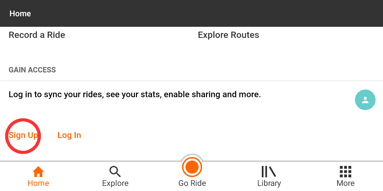
Before your ride download our routes somewhere you have decent internet access. First tap the ⋮ More button then Open shortcut. Enter the five character alphanumeric code we give you and you will be prompted to enter your name etc for verification purposes before moving on to download the routes. The routes that we share are called "Experiences" in RWGPS and come with information-packed guide pages as well as the navigation. The download will be several megabytes but doing this in advance means you won't be using data on your ride.
RWGPS Help - Accessing Experiences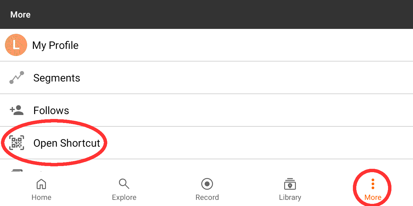
Once downloaded you'll be taken to the main Experience page. From this page you can click on the View Routes image to see a list of all routes contained within the overall Experience. It is better to click on each of the headings below that image though. Each heading contains a page or more of additional information. Each day has its own section with links to the navigation and more of a description of what the route is like. Occasionally a day will have a choice of longer or shorter, hillier or flatter routes. These will be explained within the page for each day. Tap on a route to see an overview of the map, distance and elevation. On the map are icons showing Points Of Interest (POIs). Tap on the icon for more information. A POI can be something notable like a castle, or nature site or something more essential like a toilet or place to eat.
RWGPS Help - Battery saving tips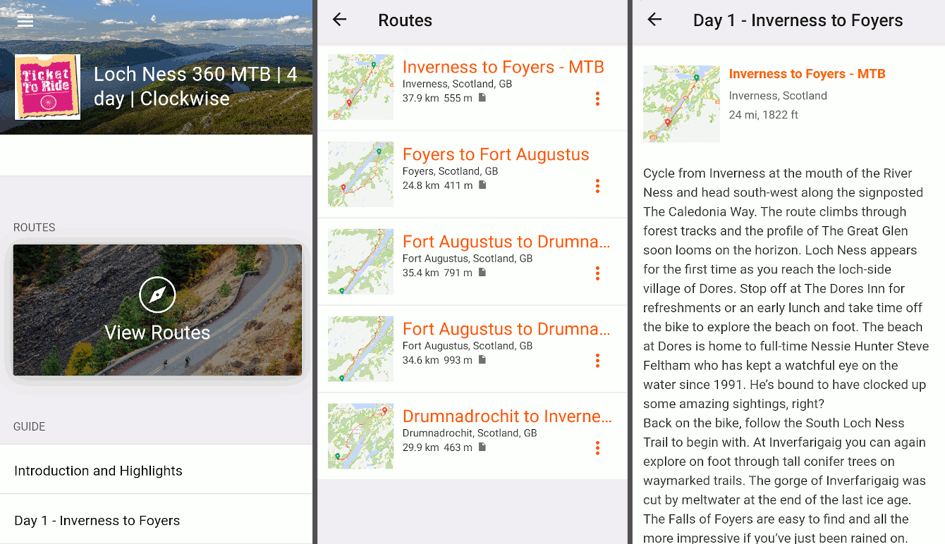
Tap Navigate from either the Route or Guide page. The first time you tap Navigate, you will have to give permissions to access the GPS for Navigation to work properly. The buttons along the bottom let you view different details about the route you are navigating. Metrics shows speed, time, distance and elevation gained. Elevation shows the route profile and your position along it. Cuesheet shows all the spoken cues should you want to review them. Tools opens up volume controls and other settings you might want to investigate once you have mastered the basics.
RWGPS Help - App settings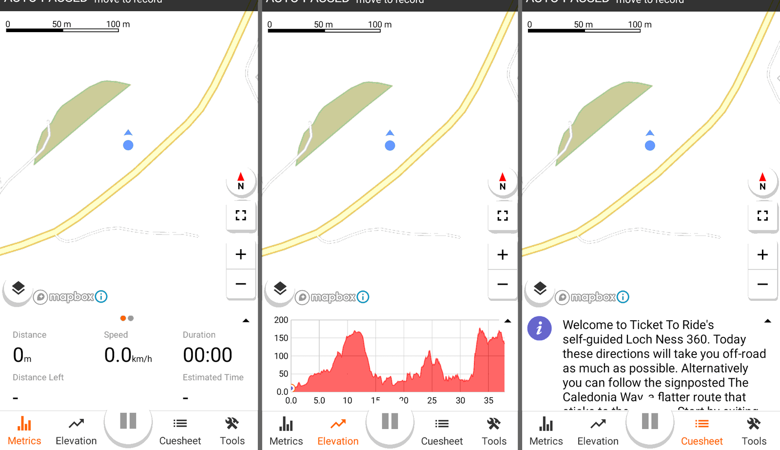
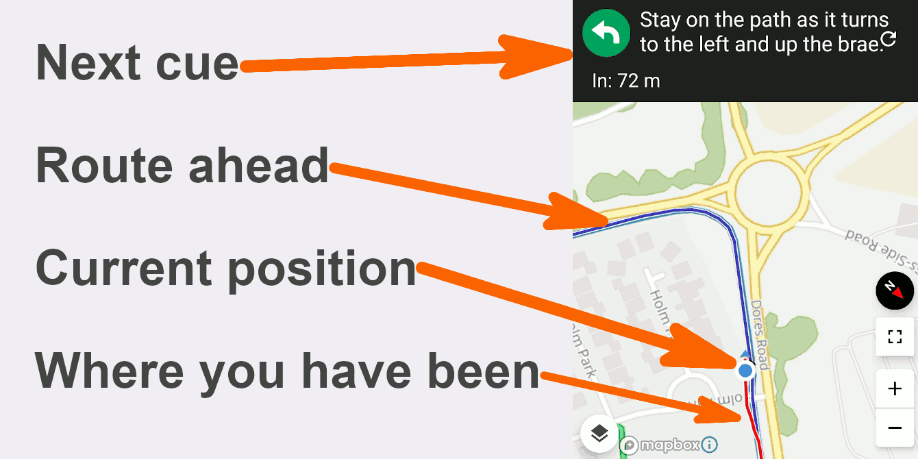
While navigating you can see where you are on the map with the blue dot, the planned route you are travelling on a blue line and where you have actually been in a red line. When you are are on course or a spoken cue is imminent the app will play a happy sound like this:
If you stray off course though it will make a more disapproving noise like this:
Sometimes you'll hear the disapproving sound even when you are on course. This doesn't happen a lot and is mainly when the GPS signal is weak because of trees or if there are two paths/roads running parallel.
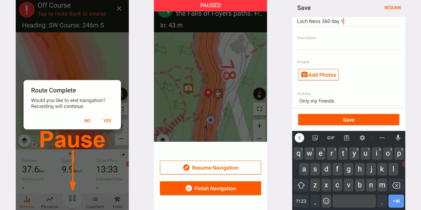
At the end of the route the app will announce "route complete" and ask if you want to end navigation. You then have the option to continue riding and recording your location but without the app complaining you are off course. Most likely though you'll want to end recording too at this point. Hold down the pause icon to end the recording. You can then choose how to save your recorded ride, add photos, change privacy etc.
RWGPS Help - Saving your recorded ride